Showing posts with label GPS. Show all posts

Thursday, December 6, 2018

Rainy Day Friends

CT Polar Bears in Montgomeryville, via automobile, from left: Grumpy, CT Blogger, Pogy and Captain.
Thank you Bernie Walsh for taking the photo!
Motorcycle Polar Bear Blog, Polar Bear Grand Tour, DRIVE to Montgomeryville Cycle Center, December 2, 2018.

By: CT Blogger
Photos by: Grumpy

It is said that there are sunny day and rainy day friends, the latter being more reliable and resilient. Perhaps such is too philosophical an argument for our Sunday Polar Bear excursion. Pogy put it better, "Oh great; six hours of ragging on each other!" One advantage of riding together in the car is that we get a lot more taking time together. Even riding together all day on bikes, we get less than an hour to talk. Sunday's drive was a real treat.

I am not ignorant of the perception that a six-plus-hour drive to nowhere in the rain is crazy. As it turned out, we had great fun the four of us. At the end we were all glad we went, and went in a car.

Sunday's forecast was for rain. Weathermen disagreed on how much and when. Some were saying thundershowers would end by morning. Some called for clearing in the second half of the day. Still others suggested an all-day thunderstorm threat.

Me, I'm getting too comfortable these days to desire a whole day of riding a motorcycle in the rain. It's one thing if you're touring and have to. Even more acceptable is the unexpected shower. You suit-up and take it. But purposely starting out in the rain, in the winter, riding all the way to Pennsylvania and back, seemed excessive.

So I called Captain and suggested we consider a four-wheeled alternative. We'd discussed just such a possibility the night before. Captain's weather forecaster was more optimistic. He answered my call from the Dunkin' in Stratford with his rain suit on and his Honda Goldwing parked outside in the steady drizzle. "See what Pogy thinks and call me back," he suggested.

I called Pogy and his National Weather Service forecaster was more dismal. Pogy had even called the tower at Sikorsky Airport in Stratford. He was flat out against riding but willing to spend the day with us in a car. He even offered to drive if Captain and I could get down to Norwalk.

Captain easily agreed to driving instead of riding when I called him back. So he rode his bike back home, quickly stripped off his motorcycle gear, changed into regular clothes, got in his car and drove over to pick me up, most conveniently, at my house.

Meanwhile I guessed Grumpy might be going. He's a Connecticut Polar Bear regular; he's even adjusted his work schedule to open up Sundays for riding. Fortunately, I got him just before he headed out the door, also all dressed in rain gear, and ready to roll on his Harley. He wasn't dead set on riding either. He quickly changed clothes and drove his pickup down to the Dunkin' to go in the car with Captain and me. (Maybe we're all valuing our comfort a bit more these days.)

As it turned out, we left only five minutes later than our originally scheduled motorcycle departure.

On his drive down from Derby, Grumpy heard on the radio that I-95 was shut down in Westport for an accident. So  I called Pogy, rerouting him to the Merritt Parkway for pick up.

If we had gone on the bikes we would not have known about the accident. We would have been sitting, dead stopped, on the Connecticut expressway, in the rain, with Pogy waiting at the rest stop, in the rain, wondering what the heck had become of us.

So we were lucky in that. But our luck didn't hold.

It rained steadily all the way over to our destination. All day, all the way there and back, we saw heavier and lighter periods of rain, never a thunderstorm, neither a respite.

Pogy originally lobbied for a route over the Tappan Zee Bridge (we all decided not to call it by its new, politically-motivated, name) to I-287 to Route 202. It saves us slogging over the all-too-familiar NJ Turnpike or Garden State Parkway. In a car it was even easier and Captain was amenable.

Captain's sophisticated Subaru GPS refused to recognize his voice, or Grumpy's or Pogy's when we tried to change her mind on I-287. She was refusing to go the way we wanted. Finally, I was able to use my "computer speak" to get through to her and she acquiesced to Route 202.

Over more than a decade of riding to Montgomeryville, I think we've probably covered just about every route and approach. The destination is positioned such that there are a variety of options, one even includes a scenic covered bridge. At one time or another we've ridden then all. Today we figured to work diagonally down Route 202 from the more westerly I-287 beltway.

Route 202 isn't too bad once you break free of the pharmaceutical suburbs. The initial stretch near I-287 is pocked with stoplights and shopping plazas with the attendant traffic. Further out it is less interrupted and more scenic. It is familiar to us for multiple Polar Bear destinations. We were recalling some of the now defunct destinations. What ever happened to the Knights of Columbus?

(We also passed NorthlandZ on 202, the world's largest model railroad layout. Once again I promised myself a trip to see it . . . someday.)

Somehow our GPS got a bit confused as we closed in on our destination. We did a bit of suburban dodging in Chalfonte, Penn., before coming out at the dealership. Still we arrived right at sign in, 11:30 as planned.

On motorcycles our communication with each other for the hours involved is relegated to hand signals. We get to talk at lunch and even more briefly at the occasional rest stop or coffee break. But in the car, whoo hoo!

We delight in making fun at each others' expense, and sometimes our own. With some 16 years of Polar Bear riding together, we have plenty of ammunition. There's also an interesting political dynamic. I am the token liberal in a cadre of Glen Beckian, Fox Newsian, Trump Loving, Army-Navy-Marine Veteran, conservatives.

Grumpy early on gave a very convincing, cinema verite, soliloquy of his general thoughts about other drivers. The rest of us agreed we probably do not want to know what Grumpy is thinking, maybe even saying, inside his helmet on our many motorcycle rides. A few insights learned: he does not appreciate drivers who wantonly touch their brake pedals, he dislikes aggressive drivers weaving in and out of traffic, he feels most people are not going fast enough -- especially in the passing lane, he doesn't like . . . well, let's just say he takes great umbrage at a whole panoply of driving indiscretions.

Grumpy's not-so-secret is that beneath his gruff and often animated exterior beats a truly generous heart. He saved me years ago on my first Daytona ride. He barely knew me yet shared his campsite with me and another rider when our only other choice was a camping "site" literally next to the sanitation dump tank. His home is refuge for family and others. But don't you dare call him a sweetheart.

Pogy regaled us once again with his stories of world travel. He was triggered by Grumpy's stories about his global work making sure we all can enjoy cable TV. Together they commiserated about dealing with international cultures in ways not for publication.

On a tangent, Captain shared stories from his property management days. I thought I’d heard all his stories by now — a danger with longtime friends — I was wrong! Captain has lots more juicy content.

Our drive back took the scenic route to cross the Delaware River at New Hope. Great plan but the bridge was out. Not the one over the Delaware. A smaller bridge cut off our pathway within site of New Hope. The only detour sign we saw pointed us directly toward the defunct bridge.

Captain's GPS knew only to run us in a big circle right back to the impassable bridge. So Grumpy and I got out our phones and started navigating via Google Maps. Able to see a larger scale, we headed back the way we came, made a big loop, and ended -- finally -- on I-78 eastbound.

We all agreed such navigation would have been miserable on motorcycles, in the rain. Even the turnaround at the bridge detour would have been daunting.

So when the drive was done and the day complete we all decided it was not such a bad idea after all to come in a car. We earned a mere one-point each on our Polar Bear schedules. Still we were dry and warm and entertained.

Next week looks to be dry but very cold, perfect weather for Polar Bear motorcycling. The destination is just 10 miles south of Montgomeryville, so it will be interesting to see what route our ride leader takes. Fortunately, we already know about the bad bridge for the ride back.




Sunday, December 6, 2015

Notable or Notorious Connecticut Bears?

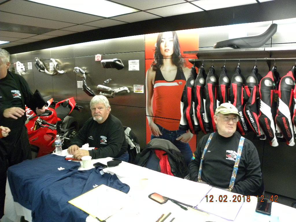
Montgomeryville Bears, from left: CT Blogger (your's truly), Token2, Captain, Mac, Fonz, Princess and down front of his own volition the Pogster.

Motorcycle Polar Bear Blog, ride to Montgomeryville Cycle Center, Hatfield, Penn., December 6, 2015.

By: Chris Loynd

There's a line in the movie "The Natural" where Robert Redford's lead character baseball great Roy Hobbs asks sportswriter Max Mercy (played by Robert Duvall), if he ever played the game. "No," Mercy answers, "Never did. But I make it more interesting to watch."

Perhaps this blog makes some small contribution to making the Polar Bear Grand Tour a bit more interesting. And for the record, I do ride with the Polar Bears, and from Connecticut.

We knew early on that more than our Connecticut contingent read this blog. It started with the Captain and his hat. Pretty soon random strangers came up to him at Polar Bear meets addressing him by his blog promulgated moniker. It happens still. It happened just today.

Last week we created a new character in the Connecticut Bear's Pantheon. I had christened her Long Distance Diva. But Captain crowned her a Princess last week. And that's the name that stuck.

So much so that when I signed in this Sunday, Flight B Leader Jim barely said hello before he blurted out something about his girlfriend, or was it my girlfriend, did we bring her? Is she here? I had no idea what he was asking and mumbled a confused, "Huh?" "The Princess," he said emphatically, "Did she come this week?" "Oh. Yes," I replied. "She's out in the parking lot yapping, I mean, holding court."

Joanna was surprised, and I think secretly delighted, to see her sign-in sheet decorated, presumably by our Flight B Leaders, in a fashion befitting her station.


So whether you see us as notable, or notorious, we are happy to have you share our adventures.

Token2, back from his European travails, was pressured into leading this week's ride. He made the mistake, I guess, of riding up to the Stratford Dunkin' Donuts where our rides begin. (Usually we pick him up en route because he lives farther west in Connecticut; in fact, about as far west as one can live in our tiny state.)

Like Fonz last week, Token did a stellar job of leading . . .. right up to the point where we actually had to find our destination. Like Fonz, he exited too early. Either that, or he wanted us to tour the lovely holiday decorations of Chalfonte.

It is amazing how Pennsylvanian everything looks as soon as you cross over the Delaware River. Maybe it's because we come ashore at New Hope. Houses and businesses are lovely field stone with big wooden doors and wooden window shutters. They line narrow streets. Everything turns colonial. At lunch Joanna commented on seeing a sign for the Cock and Bull restaurant. She's heard of cock fighting and bull riding, but was shocked at such a name for an eatery.

(By the way, Token2 ditched the scenery on the ride home. He insisted on sticking to the Interstates, striking out for I-78 east, which led us through miles of retail that looked like every endless American strip mall. One notable exception was the fake silos on the truck weigh station buildings on I-78. Nice touch PennDOT, nice touch.)

We always have a bit of trouble with Montgomeryville. For one thing, our leaders -- me included -- never seem to be sure if we are approaching it from north or south and therefore are looking for it on the left or right. One year I famously missed catching it on the right because I was expecting it on the left and rode right past. It's not like there's a giant building and a big sign and a parking lot filled with motorcycles. All but my wing man, ever-faithful Russ, jumped ship and exited for the dealership. Russ is the world's best motorcycle wing man. He'll follow you up a tree, if that's where you're headed. Then there's the infamous story of Captain leading a ride all the way here to Montgomeryville Cycle Center on a day the Grand Tour destination was elsewhere. He led on, and on, ignoring boisterous protestations by his followers. As Captain says, "The minute I crested the hill, I knew I was in trouble." Hey, anyone can push the wrong button on a GPS, right?

At at stop light, somewhat close to our destination, Token shouted to me asking on which side he should expect the dealership. I just shrugged my shoulders. For the record, it was on the left, well actually on the right if you were to continue down the highway, but you have to exit to the right on that little spur which means the dealership is now on your left. If you've been here you know what I mean!

The folks at Montgomeryville Cycle Center always treat us very well. It took them a few years to get the Polar Bear thing down pat. Their first year hosting they went all out with a pig roast. And it snowed. Now they offer a hearty chili with fixin's, including corn bread, and a brownie. It is tasty, piping hot and served fast, as was the coffee. We all had seconds. Thank you!

The dealership also offers good deals on their stuff for us Bears. They were selling Warm and Safe jacket liners for half price this year. I was tempted to buy a second one as a backup to the liner I bought just before the season started.

One year, Fonz brought one of his buddies and the guy ended up buying a motorcycle . . . well you can't actually buy a motorcycle on Sunday in Pennsylvania. He fell in love with a motorcycle and then went back the next week to buy it. He hasn't ridden with us since. I don't think that's any reflection on his motorcycle or the dealership. The cold weather thing just did not resonate for him.

Montgomeryville has often been a weather-challenged destination. But this season we've not yet earned our "Polar Bear" status. The weather has been unseasonably warm; not that I'm complaining. Joanna was grousing about seeing frost this morning. Wait until we're riding the whole day with sub-freezing temperatures.

Our plight was summed up by a guy in his shirtsleeves just coming back to his car in the rest stop parking lot at the top of the Garden State Parkway. We were just dismounting and pulling off helmets and gloves. He asked Pogy, "When was the last time you guys were riding on the first weekend of December?" "Last year," Pogy answered back. And that, my friends, is the essence of the Polar Bear Grand Tour.


Fonz checks in at Flight B. Where's the Princess?

Thank you Montgomeryville Cycle for a great feed!

Delicious and perfect for even warm Polar Bears.

The ride home was in temperatures near 50.

Even with the stop at the top we made it home with a bit of pink left in the sky.


Sunday, March 4, 2012

Highlands, NJ, February 26, 2012, Polar Bear Motorcycle Blog


Polar Bear Blog, February 26, 2012, Highlands, NJ.

By: Chris Loynd

Often I tease my fellow riders, boasting that my position as blog author makes me final arbiter of truth for our Sunday rides as reported here. But this one I have to own. This one I have to admit to. It was too egregious. There were too many witnesses. Physical evidence remains.

The worst led ride in Polar Bear history found me at the front, in charge, at least until the mutiny occurred.

Sunday's debacle was not my intention. It all seemed so easy on Google Maps.

Our Polar Bear rides are, by necessity, heavily dependent upon the New Jersey Turnpike and Garden State Parkway. When I consulted Google Maps for our route to Highlands, N.J., it offered three alternatives. One was way too familiar: down I-95, over the GW Bridge, down the Turnpike. The other was just as well worn: Tappan Zee to GSP. Then there was a third option.

So I thought to myself, “Hey! This is just 10 minutes longer. And it is the road less traveled – by us at least. It might be fun to take I-278 west down through Queens and Brooklyn, over the very cool Verrazano-Narrows Bridge and across Staten Island and then down Route 9. We would never even touch the Turnpike or Parkway! And how bad can the traffic be on a Sunday morning?”

I successfully navigated my Garmin software to map out the route, complete with way points. I then transferred it to my sophisticated, on-board, computer, global positioning, satellite receiver.

As it turned out, I should have used the wax pencil on my mirrors.

Any confidence I have built for my GPS over the past two years was shattered in a single Sunday. There is no longer any trust between us.

At first we had a grand time. Garmin and I were simpatico. I was really enjoying the urban twisties as the Hutchinson River Parkway became even more serpentine south of the GW Bridge. All too soon we were at the Whitestone Bridge. And there is started.

They have those damn toll gates. And it turned out that Pogy carries his EZ Pass mounted to the inside lid of his saddlebag. So when it did not read, there was a substantial time loss as he dismounted, opened the bag, handed the transponder to a disapproving toll clerk, remounted . . . well you get the idea. Our group came apart.

Exiting the bridge I saw a left-side turnout of sorts. It being New York City there was no shoulder on the right side. I pulled in there and waited for us to regroup.

We launched back onto the expressway, a feat of itself in traffic.

Then I missed a turn.

Leading a group of bikes, six were behind me, severely limits your options for navigation error recovery. If I had been by myself, I would have managed it all okay. And I would not have to report my stupidity in this public forum. Heck, I might have even paid three tolls for the Whitestone Bridge. I might have, if it was just me.

Instead, I blindly followed my GPS into bedlam. At lunch only then did a fellow rider reveal the causal element. “Sometimes when you miss a way point, your GPS will route you backwards to that point, instead of pointing you forward to the next one,” Token2 explained. “A better way is to plug in each point-to-point as a separate trip.”

Ignorant of that Garmin foible, and mildly panicked about missing the expressway after the bridge, and with a gaggle of conflicting opinions about the right way out of the mess, I found myself on the on-ramp headed back north to the #$%^& Whitestone Bridge, when I wanted to be going south away from the bridge.

A solution presented itself. One or two of my fellow riders even concurred. But not all of us executed the solution flawlessly.

Fortunately, no one was injured. Mac's rack should be able to be bent back to its original position. (Flag rack. On his bike. Geeze! What were you thinking?) Captain's front end may need replacing. But it's a Honda and therefore plastic and presumably only a money matter, perhaps even covered by insurance.

All that on my mind and a second wrong turn soon after recovering from the bridge roundabout and Token2 rode up with an offer to lead me to an easily discernible path, at which point he offered that I could attempt to regain any shred of dignity I might by retaking the lead. I was defeated. I agreed.

As we headed Token's way, me in the second position, I saw straight ahead of me the freeway ramp for which I'd so frustratingly searched. It was right there. It was straight ahead. It was the way point my GPS had been seeking. I should charge ahead and take it! The light turned green. I meekly followed Token instead, turning left to go a different way than my brilliant, desktop computer plan.

Eventually I recovered and saw the Verrazano-Narrows Bridge ahead. Holy crap! Thirteen dollars? The toll is $13? Oooooh, ouch! I should have Googled that the night before. It might have changed the whole route right there, and saved me the embarrassment of this ride.

I have always wanted to ride this great bridge on my motorcycle. When it opened in 1964 it had the distinction of having the longest suspended span in the world. Greater than even the Golden Gate Bridge. The mighty towers at either end holding up the span actually are built to lean away from each other to allow for the earth's curvature. Each is held together by 3 million rivets and a million bolts. John Travolta danced around the mighty suspension cables in “Saturday Night Fever.” I had never been on the bridge on my motorcycle.

Myself, I gladly paid the toll. It was a thrill, even if it cost something like a dollar a second. But I would not have foisted that fee on my fellow riders without their prior consent. Lunch cost just $20 apiece, for heaven's sake, and was really good, and lasted an hour.

It will be a month before I get my EZ Pass statement. However, according to MTA's web site, the motorcycle EZ Pass is heavily discounted and cost us only $4.18. The $13 sign was for cars paying cash. By comparison, New York should have whacked us $2.09 for the Whitestone Bridge and actually charged us more, $4.75, for the far less dramatic Tappan Zee Bridge.

But you know how it is. These guys will forever remember the $13.

Over the Verrazano and rocketing across stately Staten Island, a perverse thought crept into my head.

Things were settled down now. We were back in our groove. And I wondered, if only for a moment, I wondered, I was still in the lead mind you, I wondered if these guys would all follow me if I just now dove off on some random exit. My voice of reason told me I had instigated enough confusion for the day and any shenanigans would be poorly received.

At lunch I did offer my return route up for a vote. The resounding majority was for the good old, boring Garden State Parkway. And off we trudged yet again.

Monday, January 16, 2012

Lake Hopatcong, NJ, January 15, 2012, Polar Bear Motorcycles Blog


Lake Hopatcong, NJ, January 15, 2012
Polar Bear Motorcycle Blog

By: Chris Loynd

We finally got some polar bearish weather for our winter motorcycle rides. Sunday the temperature was 17 when I started out. By the end of our ride temperatures had not climbed even 10 degrees. I finished at a still frigid 24.

As I pulled up to the Dunkin' Donuts launching point, just in time, maybe even too close to just in time (had some trouble finding my really cold weather gear), Captain was holding court to determine who would lead. Since I was so close to the start time, and it was so cold, I left my bike running and my helmet on. So shouting back and forth, Captain and I had very poor communications.

We tried to goad Fonz into taking the lead. "I can get us to New Jersey," he offered. We then suggested he could sweep instead. Actually Fonz is a good sweep. He's responsive, proactive and cars move over for those funky lights of his.

I was trying to suggest that whoever was leading would take the more scenic route that I had suggested earlier in the week in my e-mail setting the time. Captain answered that Pogy and Token2 were picking us up en route. So I shouted back I would take the lead and pulled out to start our line.

Captain pulled up next to me and I wanted to confirm where we were catching Token2. My plan was to stick to I-287, crossing on the Tappan Zee bridge. Captain said yes, that was where Token2 would be waiting. As John J. pulled into the group of bikes, I took off. Only at lunch when communications were again established, and this time without helmets in our way, I found out Captain felt I stole the lead from him. He was gracious in conceding it all the same.

Looking at Google Maps the week before our ride, I had spotted a nice rural route alternative that added only a few minutes more to our ride. Instead of riding I-287 to I-80, expressway all the way, Route 23 took us up through some New Jersey woodlands.

As cold as it was Sunday, I probably should have checked the topographic or satellite view of my proposed "scenic" route. At the very least, the section riding on "Oak Ridge Road" should have tipped me.

As I led my motorcycle buddies off the Interstate, we started climbing into the New Jersey mountains, well, if not mountains, at least foothills. My GPS said we topped out near 800 feet in elevation, not all that much. Then again, we started at sea level.

Oak Ridge Road really does run on a ridge, or up on the western side of a ridge. It was scenic, but as we passed a bank, it informed us we were back down to 17 degrees. Another one warned of minus nine degrees, but that was Celsius; that's15.8 degrees Fahrenheit.

Scenery did not disappoint. We rode past some beautiful lakes and reservoirs, along steep rock falls and even had some twisty roads for one little bit. It was a nice break from the Interstates.

Another reason I should have taken a closer look is that maniac turn from Route 15 onto Route 181. You no sooner exit then cut back, almost like you're getting back onto 15. The GPS shows this curly-que which is technically accurate by mind boggling. More than a few times, we've missed or nearly missed this turn.

Fortunately Captain was on his p's and q's and made the tight right flawlessly. Me, I was trying to signal and wave with one hand, push the bars out with the other, coordinate brake and throttle. I went way wide, but I made her all the same. It musta' looked ugly in the back of our pack, but I received no disparaging comments.

Only after settling into Route 181 did I remember, "Oh yeah. That #$@*& turn gets us every time." I believe on past rides it has engendered a few U-turns.

Slower speeds of scenic secondary roads did little to alleviate my tingling-cold fingers. My Gerbing gloves are fine, up to a point. But for my long, skinny fingers, they just don't make it at these temperatures, even inside hippo hands. I should have known better. So for the ride back I switched to my down mountaineering mittens from NorthFace with a chemical heat pack in the end of each. Those are almost too hot. Almost.

Our Grand Tour hosts received their new shipment of this year's rockers. All of us on this ride have already earned the red rocker. Captain, of course, received red and gold. He is eligible for his 60-point pin too, but our flight leaders did not have them yet.

Wearhouse Grill had a special Polar Bear menu that included onion soup in a crock and chicken noodle. At first John J. ordered the chicken. But when most all the rest of us ordered onion, he caved to the peer pressure. Captain stood fast, however, when his turn to order came and resolutely ordered the chicken noodle. Maybe he knew something we did not.

As it turned out, they brought his chicken noodle right away. For the rest of us our soup came after our entrees. The soup hit the spot on such a cold day.

We missed Grumpy. He is back on night shift at his job keeping all our cables full of television shows. Fonz took over most of the photo duties. Anticipating Grumpy's absence, I packed my tripod and took the group shot. To see a version of this blog with more pictures, follow this link: http://www.influentialcom.com/polar_bear_blog.htm

Pogy surprised me by saying that this Blogspot blog was the only one he knew. He got a new computer and I e-mailed him links to save to favorites on his new browser. Guess he'll have to do some back reading. Several seasons of motorcycle polar bear blogs are posted on this other site.

Generally I post here on Blogspot first because it is easier to access from anywhere. I am also experimenting with SEO for both my blogs. The other blog site is on my former company web site. There I have more control, and room for all the photos I wish to post. I generally also use Photoshop to size and sometimes crop or adjust the photos. And that program is only on my home computer. Blogspot I can use from my small laptop or tablet.

My Blogspot blog also allows comments, but my readers rarely do.

Eventually, I will have to upgrade my company web site. New web management tools will offer much of the same functionality. All I have to do is learn a whole new program. But hey, we all know what that is like. This technology treadmill never ends.

Thursday, December 30, 2010

Polar Bear Snydersville, PA, December 19, 2010

Snydersville (Stroudsburg), PA, December 19, 2010

By: Chris Loynd

It was just a really nice day for a Polar Bear motorcycle ride. A threatening snow storm stayed out to sea. Attendant clouds kept the temperatures above freezing, mostly above freezing.

Grumpy is back. I knew it was him as I approached the Dunkin' Donuts jump off point in Stratford Sunday morning because he was at the head of a line of bikes ready to pull onto Lordship Boulevard . . . without me! He has left without me before, just left me to ride on my own for the lack of a mere minute or two waiting for a late comrade.

I was not late this time. My GPS, hyper-accurate time was 8:30 a.m. Well, okay, that's a lie. It read 8:31 as I pulled up to the line of bikes poised to leave . . . without me, as I said.

My usual M.O. is to arrive just as our guys are suiting up to leave. Okay, so I cut it a bit tighter than usual last Sunday morning because my wife Cynthia's computer was still predicting snow. Worried, I waited for the Cablevision forecast as I suited up. The TV weatherman said no snow. And I was off.

After eight years, the rest of the guys usually cut me a bit of slack.

It's okay for Grumpy to be punctual. He's ex-military. And he's, well, particular, very, hence the nickname.

As for Pogy and Scott waiting not-so-patiently at the Darien rest stop, I once again attest that our line of bikes departed the Dunkin' at precisely 8:31. So I don't want to hear any more guff about us being late to you guys.

In my last blog post I explored in depth the features and foibles of GPS navigation for motorcycles. I am no tech wiz, but I am well read. As I understand it, timing is everything for synchronizing the two or three satellites in geosynchronous orbit above the earth in order to triangulate my motorcycle's exact position in the world. So the time displayed on my GPS is the most accurate time you can get.

It read 8:31 as I approached our guys ready to go. Grumpy and I exchanged very little. I said, “Welcome back!” He nodded, I think disapprovingly, and dropped his clutch. Captain waved me into place with a nod of his head. There's just no way we departed Dunkin' any later than 8:31:30, no matter what Pogy says about his certified travel time from Stratford to Darien.

Except for a bout of stop-and-go construction traffic on Route 80 headed west, we enjoyed an uneventful ride to the Pocono Mountains. My odometer read just exactly 150 miles, one-way. So I am hoping my Flight Leaders give me the extra point. Captain clocked something like 308 round trip, so maybe my odometer is running a bit shy.

We decided that is maybe too long a run for some of us older guys. Next long ride, we maybe need to build in a bathroom break. One of our guys joked that he couldn't wait and just went in his riding suit. That also helped solve the problem of cold toes, at least for a little while, he said.

My GPS would probably give me uber-accurate exact distance traveled. And I am sure it is in there somewhere imprinted on a memory chip. I just don't know how to find it. Guess I had better spend some Christmas holiday downtime trying to better learn how to use the dang thing.

I also upgraded my cell phone last week. That too comes with its learning curve. It has wonderful, whizzbang features. You just have to memorize the 10,000 key combinations, 3,000 screens and 12,000 so called short cuts in order to tap the phone's potential. And don't even get me started on the million-some apps.

Smart phone my a**! If it's so smart, why doesn't it intuitively know what I want? Oh, there's an app for that?

Fortunately, I did pretty quickly pick up how to make and receive phone calls. And unlike Captain, I can text.

Back on topic, we arrived in good order, early though. Fortunately the split pea soup showed up soon after we did. Walter Kern even made a video of ever-helpful Grumpy carrying the soup for Mrs. Schoch.

Mrs. Schoch was there managing the food, greeting the Polar Bears and spreading good will. Thank you again for hosting us!

Unfortunately, Schoch's was using their spacious upstairs for other things. So we did not get any opportunity to sit down and kibbutz with one another. We stood around downstairs, had a bit of food, drank a half-cup of coffee. Somehow, I managed to still be last out to our bikes for departure. (It wasn't my fault I got caught in the longer bathroom line.)

Fortunately Grumpy was along with his camera. Mine had a dead battery. So we still managed the group picture. I am sure, in a pinch, I could have taken the photo with my fancy new cell phone. It has an 8 megapixel camera built in. I do know how to take a picture with my phone. I just don't know where it goes after I take it, or how to get a picture from my phone to my computer.

Our ride home was smooth and uneventful. Grumpy proudly offered to buy the coffees at Chez GSP. He had a $20 Dunkin' Donuts gift card. But the Dunkin' on the Garden State Parkway is not a “participating vendor.” Grumpy was a good sport and bought all the same.

I am sure there is more that happened on our ride. I fell asleep on the couch when I got home, had two, no three now, consecutive Christmas parties since Sunday. Plus Pogy and I had a very interesting discussion about our jobs and companies that affected me profoundly. And that's all I can seem to remember from last Sunday. Maybe some of my fellow bears can chime in with a few remembrances of their own.

Our next ride is a whole two weeks away. Because Christmas and New Year's both fall on weekends, the Grand Tour has decided to forgo Sunday rides on those holidays.

So in the meanwhile a Merry Christmas and Happy New Year to all.

Friday, December 10, 2010

Polar Bear Montgomeryville, Pa.; December 5, 2010

Montgomeryville, PA; December 5, 2010

Polar Bear weather: 26 degrees to start, 29 to finish, don't think it ever broke 40.

By: Chris Loynd

Longtime Polar Bear Blog readers will know that over the years I have made good fun of GPS enabled ride leaders. Now I am one.

Pulling into the Dunkin' Donuts in Stratford just as my fellow riders were dressing and getting organized, Captain and I discussed the ride and route. He asked “Who's leading?” like he didn't want to be the one. So I figured, “What the heck?” and rode out to the front of the group.

I wasn't really ready to lead.

Yes, I had looked at the MapQuest map when I formulated a departure time. I have a vague concept of where Pennsylvania lies. Fortunately, I had at least entered the destination address into my GPS as a precaution. (Thank you Bob V.)

I embraced one of these satellite receiver contraptions for my trip west. In the 7,500 miles and four weeks of our trip together, GPS and me, we fell in love. I am a convert. GPS is wonderful for a motorcycle.

Being lost in Cambridge, Mass. on the bike a few years back haunts me still. I had to stop the bike, fish the paper map out of my saddlebags, figure out where I was, memorize two or three turns to where I wanted to go. It took me six or eight of these confusing, mind-wrenching, memory-taxing stops to finally get back on the interstate, headed for home with a headache.

GPS puts the map in front of you. Nearly as helpful, it tells you how far to the next turn. Still, it has limitations.

Like most things computer, GPS comes with a learning curve. Sunday's ride clearly evidenced I have not climbed far enough up the curve.

GPS also has it's benefits. For one thing, if you are willing to surrender your destiny to a computer algorithm, GPS will take you through all kinds of interesting country. This facility has been the fodder of blogs past. Led by other CT Polar Bear GPS following leaders, we have explored the very depths of New Jersey farm country, toured some of its nastiest cities and seen paved roads suddenly turn to dirt, all at the behest of someone's GPS.

My turn at GPS roulette came Sunday. I led us all the way out Route 202 from Interstate 287. In the past we have taken the faster Interstate 78 west, then dropped down to Montgomeryville.

The 202 is a pretty ride, actually. Once you clear the stoplights, there for a while the scenery looks nice as you transition from Jersey pharmacy land to horse country to suburban ticky-tacky boxes country.

Across the bridge in New Hope, Pa., we rode past beautiful old Pennsylvania stone houses. Downtown Doylestown was actually quite charming. Apparently my GPS felt it was faster to go right through the center of town than to bypass it on the expressway.

Russ accused me of having my GPS set to “shortest route” (or maybe “most scenic”) instead of “fastest route.” I confirmed my affirmation when I got home. In fact it was set to “fastest,” although you could not have proven it by my ride navigation last Sunday. After our summer adventure together, my GPS and me, perhaps it suffers from a lack of scenery on our urban expressway-dominated Polar Bear rides.

We did, in fact, reach Montgomeryville Cycle Center. And some of our riders commented, “Well we have never gone that way before.”

Thanks to my GPS, we came at the dealership destination from a completely different direction. I'm not sure of the compass heading. I'll have to look at a paper map to figure out how we got there.

The change in approach meant I missed the turnoff. On all our previous rides, the dealership came up on the left, which is where I was looking when it quite suddenly appeared on the right. I felt it would have been unsafe to get on the brakes too hard, being at the head of a line of bikes. So I dove for the shoulder. Everyone else made the turn to the dealership.

Russ, my wing man, could have made the turn too. But Russ is one of the best wing men in motorcycling. And just like Maverick in “Top Gun,” Russ knows: you never leave your wing man. So he rode twenty miles further with me (Russ said it was more like 50 or a hundred) until we could find an exit ramp and turnaround. Russ will follow you up a tree if he is your wing man.

When I finally arrived at the Polar Bear destination, Token quipped, “We've already taken the group photo without you.” But he was only kidding.

Motgomeryville Cycle Center offered warming beef chili with all the fixin's, including corn bread. Yummy! They also served hot dogs, coffee and water. Seating was at a premium, but eventually we found a spot for all of us together at the end of a table.

Bob Hartpence, Polar Bear Grand Pooh-bah, stopped by with some interesting comments about his challenges trying to keep in touch with members via e-mail blasts. All I can say, is that this blog is 100% opt-in. If you don't like it, don't read it. Geeze! Even bikers are going politically correct?

By the way, this blog is open to commentary. The BlogSpot version allows you to post a comment right then and there. The version with photos requires you to send me an e-mail.

It was fun to see Token2 regale in this plastic-dominated store filled with metric motorcycles. He truly was happy in his element. He said to me, “Look at this half of the shop: no chrome!” A token no more, these were HIS people!

Unfortunately, he had to nestle amongst Harleys for the ride home.

Before we departed, Token2 had to purchase a new controller for his heated garments. When we got to our stop at top of the GSP (yes, I did finally lead us home), turns out John J. has had trouble with his as well. John J. sent his controller back to Gerbing and the sent it back with a patched wire. John J. is still not happy.

Considering I am a Polar Bear rider that hates the cold, I think I will purchase a second controller as back-up.

My GPS and I agreed upon a homeward route. I wanted to take the more express Interstate 78 back. Simply by hitting the “home” button, my GPS showed me a reasonable route north to I-78 then east to I-287. We had an accord and off I went, bikes trailing behind me.

Unfortunately, most of our bikes were running on fumes, a gas stop sorely needed. I passed up a WAWA, thinking a few of my guys might not appreciate an off-brand fill-up.

(We did not have Grumpy with us. That's significant because he insists not only on brandname gasoline, but also one made from oil pumped under the proper geopolitical circumstances. Hugo Chavez, you listening?)

But the road past the WAWA started looking pretty rural and I was afraid we might not find another gas station. So I circled the procession with a "U" turn, always a move open to derision, and reversed my line of march back to WAWA.

Apparently my GPS took my indecision to indicate a change in plans. And without my knowing it, the GPS took it upon itself to change my route. Captain later said he believes the GPS calculates your route depending upon which way the bike is pointed at the time.

Between the u-turn and then riding around through the filling station, I guess I performed the equivalent of spinning around the blindfolded player in blind man's bluff. My GPS got confused.
The computer still took us home, but sent me back exactly the way I came, stoplights and all.

Sometimes it's hard to tell what or who is in charge, the computer or the user. Speaking of which, I can't wait to see the new Tron movie. Maybe there is a future version where a driver gets sucked into his GPS.

Now that most all our riders are GPS equipped (I was one of the last holdouts) they at least know what I am up to, floundering around at the head of the line as I was. They can follow my every foible, turn-by-turn.

A full line of bikes behind you definitely limits your experimental navigation options. On my own, I would not have sweated the turnaround. I would have simply taken the next State Route indicating “north,” confident in eventually running into I-78.

One advantage of GPS is that you lose your fear of getting lost. My Garmin motorcycle version even has an “off road” function. I can't wait to try that out with Russ at my side. He loves dirt and gravel roads.